GEOTECHNICAL ENGINEERING
MEMPHIS
HomeInvestigationExploratory test pit

Professional Exploratory Test Pit Services in Memphis, Tennessee

Technical studies that support your project.

LEARN MORE

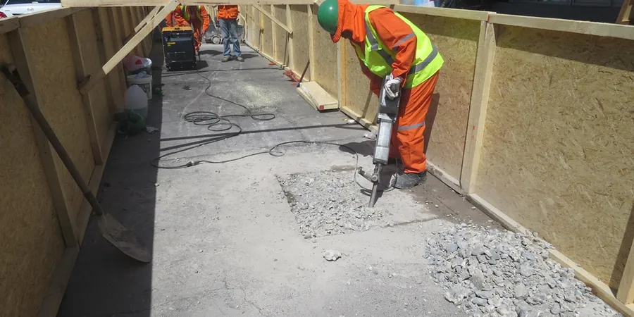
One of the most persistent mistakes we see on Memphis construction sites is the assumption that the subsurface is uniform. A geotechnical report based solely on desk studies or a single boring can miss buried debris, old stream channels, or the dramatic variation in loess thickness that characterizes the Bluff City. An exploratory test pit exposes the actual strata in plan and section, allowing the engineer to observe bedding, fractures, moisture, and the interface between the natural loess and the underlying alluvium. In a city built atop four distinct terraces of the Mississippi River, from the high bluffs of downtown to the flood-prone bottomlands near the Wolf River, skipping direct visual inspection is a gamble no prudent developer should take.

A single test pit in Memphis loess exposes more about site conditions than three borings alone—visible stratification, moisture, and cut-slope behavior all at once.

Our service areas

Methodology and scope

The geology beneath Memphis tells a story of wind and water. The city sits on a thick mantle of loess—wind-deposited silt—that can range from 15 to over 70 feet deep as you move east from the Mississippi River toward the Shelby County line. Beneath the loess lies the Jackson Formation, a stiff, sandy clay, and deeper still, the Memphis Sand aquifer that supplies the region with some of the purest drinking water in the country. An exploratory test pit lets us examine this loess directly: we log its color, consistency, moisture content, and any calcareous nodules or root casts that signal paleosol horizons. Where the loess thins near the Wolf and Nonconnah Creek floodplains, the pits often reveal interbedded silts and sands that demand a different approach to footing design and drainage. We conduct field vane shear tests at multiple depths, collect bulk and undisturbed samples for laboratory classification, and photograph every lift so the project team sees exactly what we saw.
Professional Exploratory Test Pit Services in Memphis, Tennessee
Technical reference — Memphis

Local considerations

Memphis sits at an elevation of roughly 337 feet above sea level on the Fourth Chickasaw Bluff, but the terrain drops sharply into floodplains where the water table can be less than 5 feet below grade. The city also lies within the New Madrid Seismic Zone, one of the most active earthquake regions east of the Rockies; the USGS assigns Shelby County a significant probabilistic ground-motion hazard. Shallow exploratory test pits become critical here because they reveal the depth and continuity of the loess cap, which directly influences site classification per ASCE 7-22. A site underlain by thin loess over loose alluvium may fall into Site Class E or even F, triggering higher seismic design forces. We also use the pits to check for collapsible soil behavior—a known risk with dry loess—and to assess cut-slope stability if the project involves basements or retaining walls along the bluff line.

Need a geotechnical assessment?

Reply within 24h.

Email: contact@geotechnical-engineering1.org

Explanatory video

Applicable standards

ASTM D2488 – Standard Practice for Description and Identification of Soils (Visual-Manual Procedure), OSHA 29 CFR 1926 Subpart P – Excavations (shoring, benching, and sloping requirements), IBC 2024 Section 1803 – Geotechnical Investigations (test pit observation and sampling requirements)

Technical parameters

ParameterTypical value
Standard excavation depthUp to 14 ft (rubber-tire backhoe); deeper with trackhoe
Field testing performedPocket penetrometer, Torvane, hand vane shear per ASTM D2573
Sampling methodBulk disturbed samples (ASTM D2488) and block/undisturbed samples (Shelby tube)
Stratigraphic loggingUSCS classification, color (Munsell), moisture, consistency/density
Groundwater observationDepth to seepage or free water recorded immediately and after 24 hr
Typical pit dimensions6–8 ft long x 2.5–3 ft wide (excavator bucket width)
Safety complianceOSHA 29 CFR 1926 Subpart P; shoring or benching for pits >5 ft

Frequently asked questions

What depth can an exploratory test pit reach in Memphis soils?

With a standard rubber-tire backhoe we routinely excavate to 12–14 feet in the loess uplands. For deeper investigations or sites with a high water table near the Wolf River bottoms, we switch to a track-mounted excavator that can reach 18–20 feet with proper benching. The practical limit is usually groundwater inflow or OSHA safety constraints rather than machine capability.

How much does an exploratory test pit investigation cost in the Memphis area?

A typical single-pit investigation with full logging, field testing, and sampling falls between US$540 and US$720. The final cost depends on depth, access for the excavator, number of pits, and whether undisturbed Shelby tube samples are required for laboratory testing.

How long after excavation can a test pit remain open?

We keep the pit open only as long as needed for logging, photography, and sampling—typically 2 to 4 hours. Memphis loess can stand vertically for short periods but is susceptible to slaking if it rains. For pits deeper than 5 feet, OSHA requires sloping, benching, or a protective system, and we backfill immediately once the investigation is complete.

Can you collect undisturbed samples from a test pit for laboratory testing?

Yes. We extract block samples by hand-trimming a pedestal of undisturbed loess and encasing it in paraffin and cheesecloth, or push thin-walled Shelby tubes horizontally from the pit wall. These samples are then tested in our accredited laboratory for consolidation, shear strength, and collapse potential.

Location and service area

We serve projects across Memphis and its metropolitan area.

View larger map