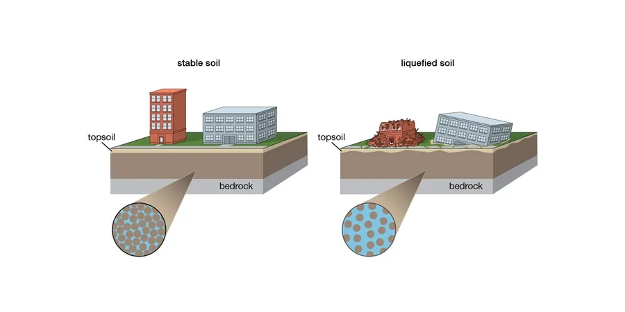
In Memphis, the Mississippi embayment sands tell a story that standard borings often miss. The city sits on thick alluvial deposits, and with a shallow water table across much of Shelby County, loose saturated sands are a routine challenge. We see this in the Wolf River floodplain and along the Loosahatchie bottoms. A standard penetration test gives you N-values, but converting those numbers into a post-earthquake settlement estimate requires more than a spreadsheet. Our team runs the NCEER (Youd-Idriss 2001) procedure, factoring in the fines content from a grain size analysis and the plasticity index from Atterberg limits tests to avoid over-conservative results that kill a project budget. When a client needs a rapid screening, we start with the simplified procedure. When the numbers get tight, we push for a CPT. Memphis deserves a straight answer on liquefaction risk, not a generic report.
A correct liquefaction analysis in the Mississippi embayment is 30% calculation and 70% knowing which sand layer to sample.