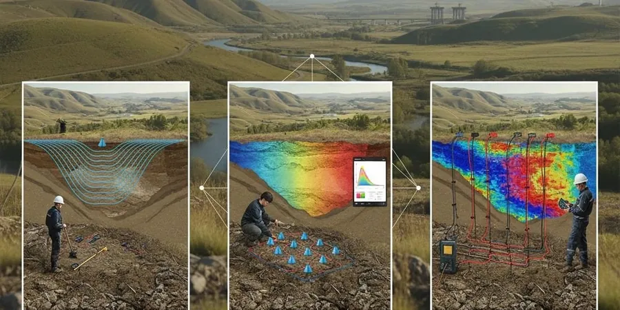
The Mississippi Embayment defines subsurface conditions across Memphis, with the Memphis Sand aquifer overlying thick sequences of Tertiary clays and the Paleozoic bedrock surface dropping to depths exceeding 800 feet in some areas. This sedimentary architecture creates distinct velocity contrasts that seismic tomography methods resolve with precision. The New Madrid seismic zone, centered roughly 40 miles northwest of the city, generates ongoing microseismicity that keeps geotechnical engineers attentive to site-specific shear-wave velocity profiles. Our laboratory team processes refraction and reflection data acquired across Shelby County, mapping top-of-bedrock elevation, identifying buried channel features, and determining Vs30 values needed for ASCE 7 site classification. Projects ranging from Memphis International Airport expansions to Mississippi River bridge foundations have relied on crosshole and downhole seismic tomography to characterize the loose alluvium and loess-covered terrace deposits typical of the Chickasaw Bluffs. When subsurface conditions demand high-resolution imaging beneath existing structures or in congested urban corridors, crosshole seismic surveys provide continuous velocity logs without the spatial averaging inherent in surface-based methods.
Velocity inversions in the Memphis Sand aquifer — where looser sands underlie stiffer overbank clays — demand tomographic inversion rather than simple layered interpretation.